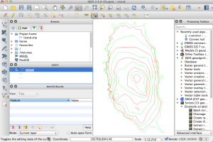
In QGis copy the area required using the selection tool.
Create a new project and Paste in the contours.
Use Documents/Mapping/QGis Projects/scale_conversion.numbers to predict the model size based on the depth of the material.
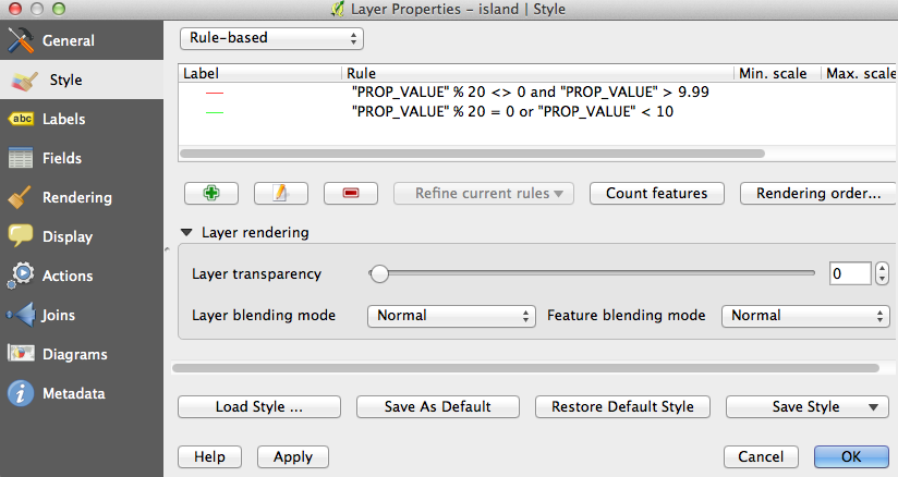
select the contour layer on the left, right click and select properties
select Style and then load previously saved style file “two_colour_contours.qml” (or copy this one, top box needs to be set to rule-based)
apply the style and the contours should be blue and green.
if below sea-level (low water line) contours appear then it is necessary to remove them by clicking the attribute table button (towards right hand end of top bar). Order by SUB_TYPE and select the low water line items, click the pencil to edit and then click the delete button.
Click Project->DXF Export. Save with symbology, don’t forget to highlight the item to be saved.